kikita & Maps

GIS,spatial and artificial intellegence learning and share

前端时间的学习分享契机,遇到了一个有意思主题 “数字表亲(Digital Cousin)”,把幻灯片整理记录一篇学习笔记。
论文的全名是Automated Creation of Digital Cousins for Robust Policy Learning,作者是斯坦福大学李飞飞带队的AI研究团队。论文结构清晰、简明扼要,我作为小白读者也可以学到很多知识。

从我的阅读角度的三个循序渐进的脉络是:

  1. 背景:为什么会提出 Digital Cousin?
  2. 介绍 Digital Cousin 的自动化生产流程(ACDC),以及其中使用的主要AI技术
  3. 针对 Digital Cousin 的机器人策略训练的实验结果和结论

Why Digital Cousin?

数字孪生/Digital Twin是个现有概念, Digital Twin 是对真实世界中的物理对象、过程、关系或行为的虚拟表达。Digital Twin 追求的是 1:1 高度仿真还原。

聚焦到机器人策略学习这个行业,Digital Twin 的应用已经非常深入且普遍了,一些大型的工厂车间、仓储物流厂商已经在用 Digital Twin场景中训练自己的机器人了。

扩展阅读:

举个例子,视频中是亚马逊的仓储物流管理车间,视频左侧是 Digital Twin 机器人策略训练的虚拟场景,右侧是现实世界场景。
由 Digital Twin 仿真环境预训练的机器人手臂,可以在实际场景尽可能地完成各种工作。 可以用于提升流水线上的工作效率,和帮助改善人类员工的工作舒适度。
Read more »

Besides the lava-spewing volcanoes we often see in the news and the underwater volcanoes introduced in the previous article, there are also dormant volcanoes hidden beneath the surface. Their heat erupts as geysers and hot springs.

06 Yellowstone

Let’s shift our focus to Yellowstone National Park in the United States. This is a dormant volcano where magma still flows underground. The heated groundwater boils, creating geysers. In some areas, water and sediments mix to form boiling mud.

This heat provides food for animals. The film features a battle between coyotes and otters, and you might come to admire the “cool-under-fire” otter after watching it.

In ArcGIS Earth, search for Yellowstone in the top-right corner to locate the park in the heart of North America.

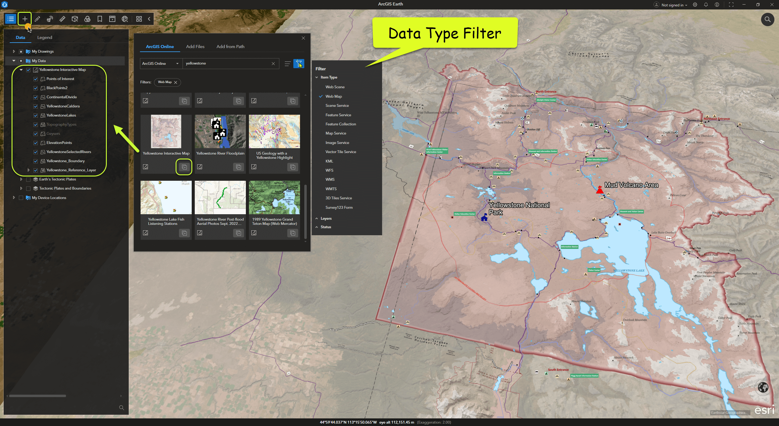
ArcGIS Online and Living Atlas offer a wealth of global open geographic data. These resources can be easily accessed in ArcGIS Earth. Click “Add Data” from the toolbar and search for Yellowstone to find many related datasets.

For instance, you can add a Web Map dataset like “Yellowstone Interactive Map” to explore the park’s boundaries and details.

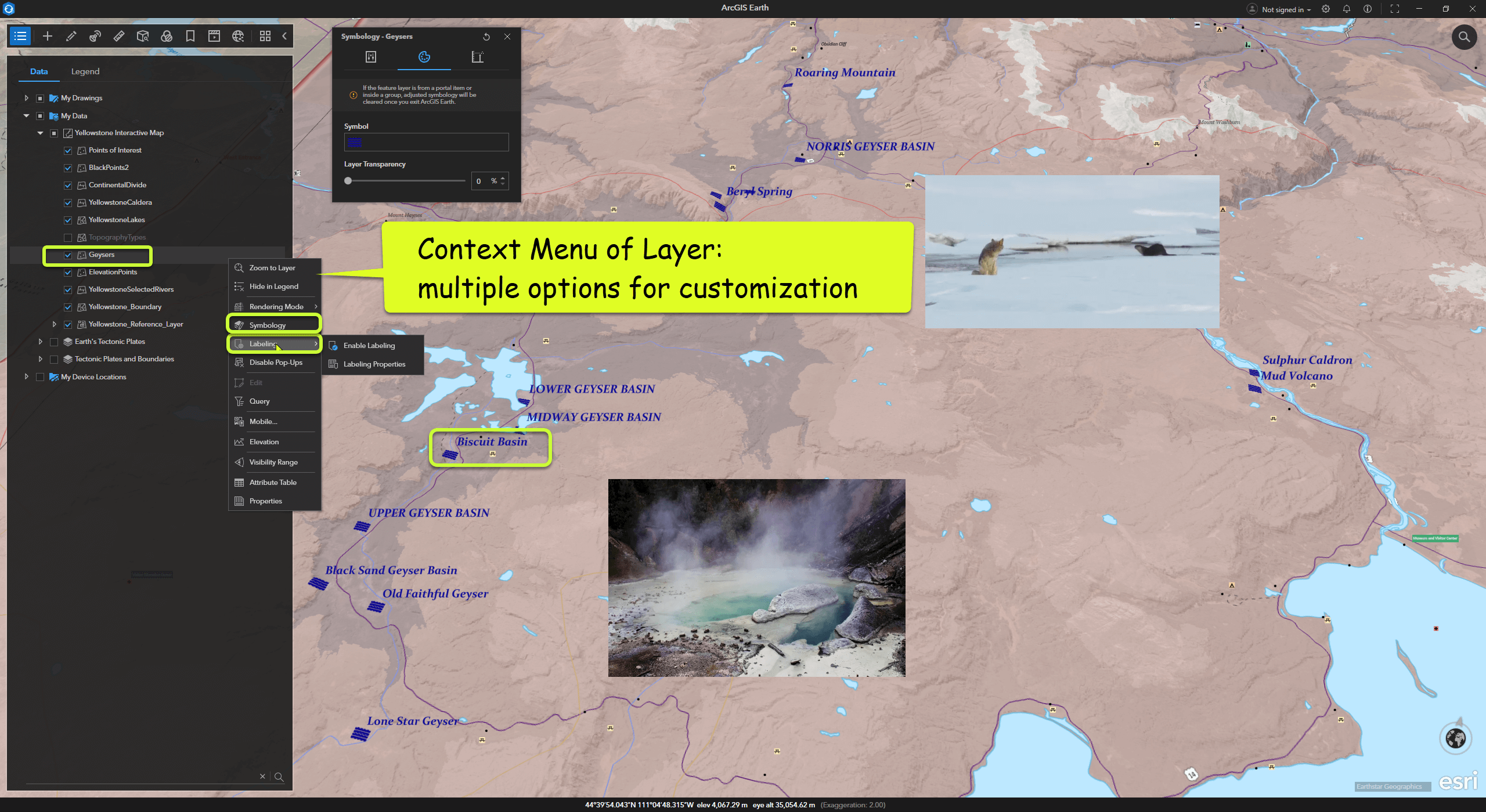
In ArcGIS Earth’s Table of Contents, each layer has a right-click menu with many configurable options, such as symbols, labels, and attribute information. Users can experiment with their map styles as needed.

Read more »

除了我们常常在新闻中看到的喷发熔岩的火山,和上一篇中介绍的海上火山,还有一些沉睡中的火山蕴藏在地表之下,其热力以间歇泉和温泉的形式喷薄而出。

06 黄石/Yellowstone

镜头拉到美国黄石国家公园,这里是一座沉睡中的火山,地下仍有岩浆涌动,地下水被加热沸腾,形成一个个间歇泉。有些地方泉水和沉积物混合液化形成了沸腾的泥浆。

这些热量为动物们提供了食物,影片中讲了郊狼与水獭的博弈,看完可能会喜欢上那个 “cool-under-fire” 水獭先生。

在 ArcGIS Earth 中右上角搜索 Yellowstone ,地图会定位到位于北美的公园腹地。

ArcGIS OnlineLiving Atlas 中提供了大量的全球开放地理数据资源,在ArcGIS Earth中可以轻松访问, 从工具条中点击 Add Data,搜索 Yellowstone 会出现很多相关的数据。

例如,添加一个 Web Map 类型的数据 “Yellowstone Interactive Map”,借此了解国家公园的范围和详情。

ArcGIS Earth 的 Table of Content 中,每个图层的右键菜单中存在很多可按需配置的相关功能,例如符号、标注、属性信息等等。用户可以按需尝试自己的地图风格。

Read more »

Volcanoes are not only sculptors of the Earth but also windows for scientists to study geological activity.

Previous Article: In our previous exploration, we embarked on a journey using ArcGIS Earth to uncover the mysteries of volcanoes and familiarize ourselves with its basic operations. Today, let’s dive further into the three-dimensional world of volcanoes and explore the possibilities of combining terrain and data.

Leaving behind the perilous Fernandina Volcano, we continue onward. Following the lens, we slide northward in the eastern Pacific…

04 Wolf Island

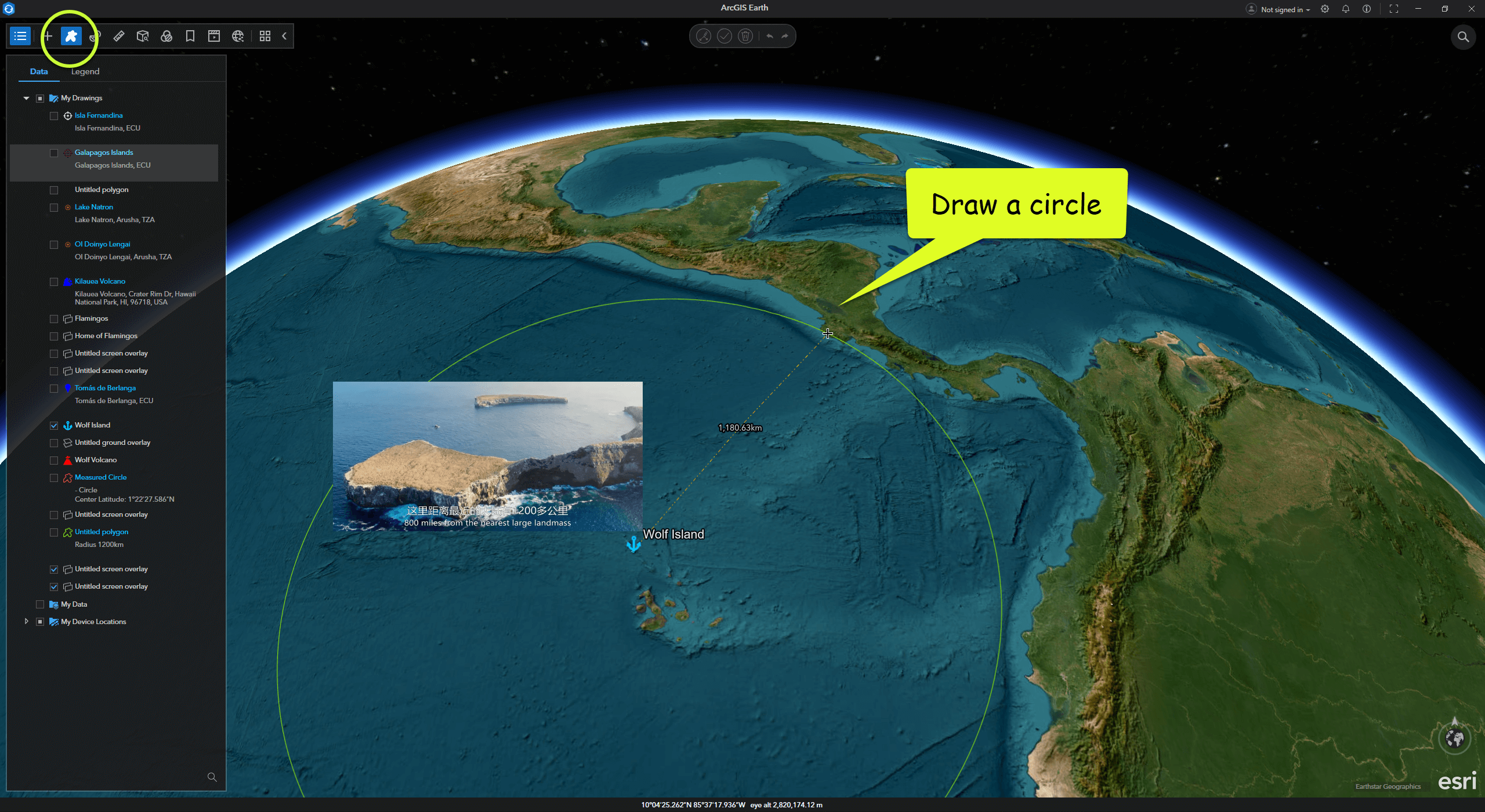
Wolf Island is a dormant volcano over a million years old, located more than 1,200 kilometers from the nearest continent. It is one of the most remote volcanic islands in the Galápagos Archipelago.

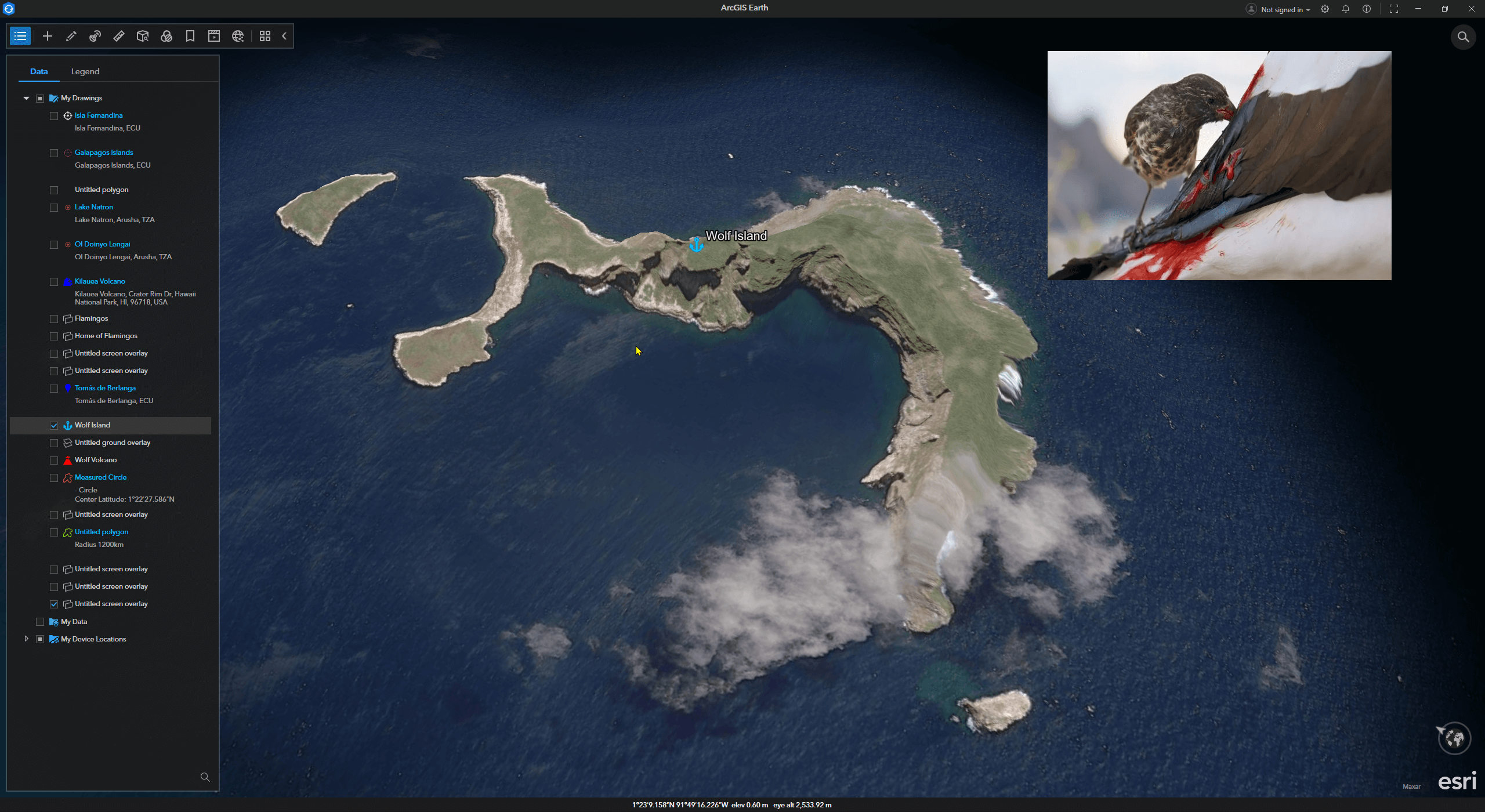
Survival on this isolated volcanic island seems to have activated “hell mode.” To adapt to the harsh environment, animals here have evolved rapidly. On this barren island, small finches have evolved into a blood-sucking species—the vampire finch.

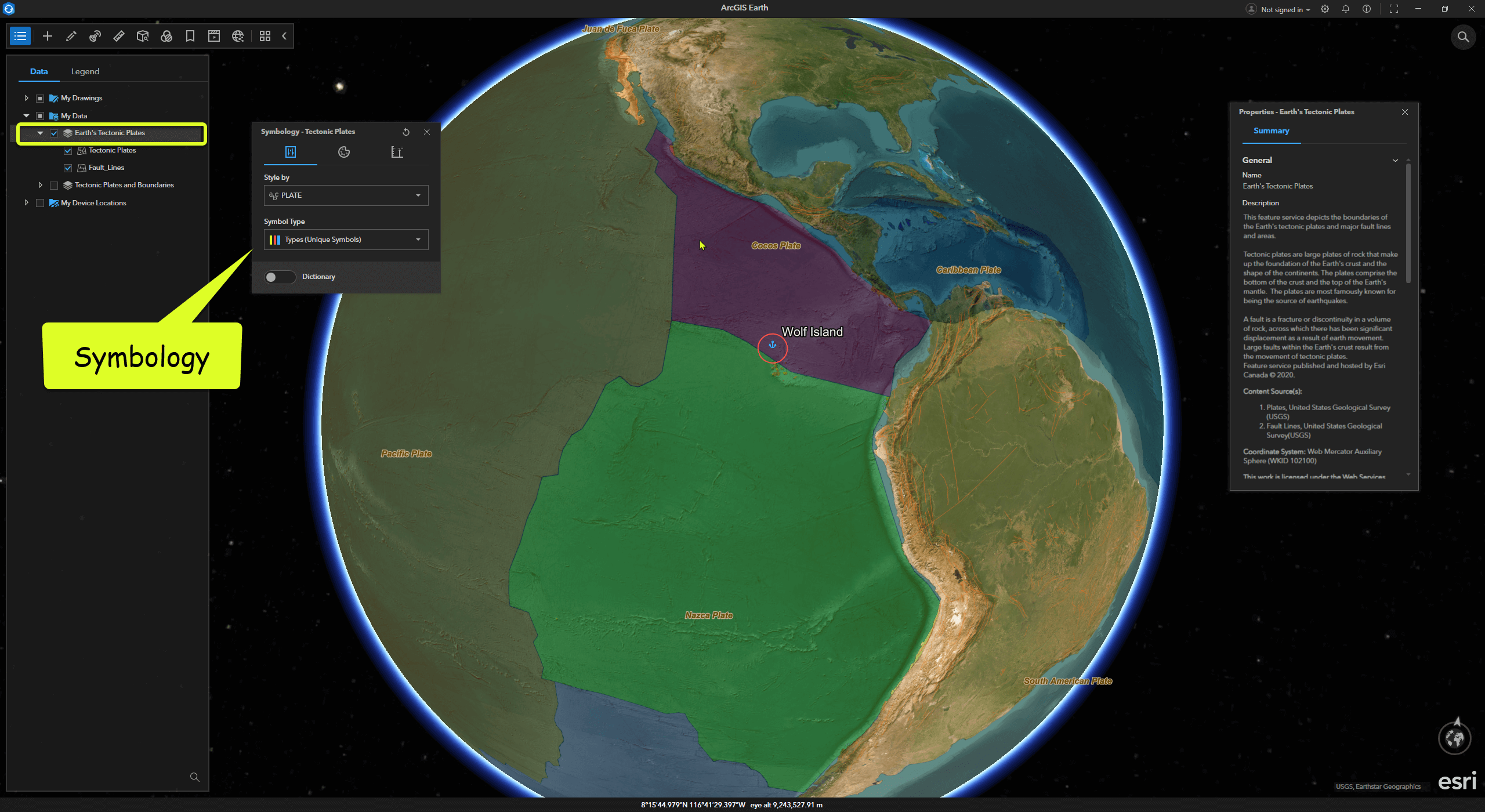
If you’re interested in tectonic plates, in ArcGIS Earth, you can click Add Data and search keywords like “Earth” or “Tectonic.” Among the publicly available resources on ArcGIS Online is Earth’s Tectonic Plates. After adding this data to ArcGIS Earth, we can clearly see that the Galápagos Archipelago sits at the intersection of three major tectonic plates: the Nazca, Cocos, and Pacific Plates.

Read more »

火山不仅是地球的雕塑家,还是科学家们研究地质活动的窗口。

上一篇 中,我们用 ArcGIS Earth 开启了火山探索之旅, 熟悉了 ArcGIS Earth 的基础操作。今天,让我们进一步进入火山的三维世界,探索地貌与数据结合的无限可能。

告别了险象环生的费尔南迪娜火山,我们继续前进。跟随镜头,在太平洋东部继续向北滑行……

04 沃尔夫岛/Wolf Island

沃尔夫岛是一座已经年过百万岁的死火山,距离最近的大陆有1200多公里。 它是加拉帕戈斯群岛中极为偏远的火山岛。

在这个孤立的火山岛上,生存似乎是开启了地狱模式,为了适应环境,动物们迅猛进化。在贫瘠的小岛上,小小的鸟雀为了获取食物,已经进化成了嗜血的新物种——吸血地雀。

如果你对大陆板块感兴趣,在 ArcGIS Earth 中, 点击 Add Data 并搜索关键字 “Earth” 或 “Tectonic”, ArcGIS Online 中的公开资源 —— Earth’s Tectonic Plates。添加此数据到ArcGIS Earth后,我们可以清晰地看到,加拉帕戈斯群岛位于纳斯卡(Nazca)、科科斯(Cocos) 和 太平洋(Pacific) 这三个主要的构造板块的交汇处。

Read more »
0%