Volcanic Islands and Atolls — Exploring and Interpreting with ArcGIS Earth
Volcanoes are not only sculptors of the Earth but also windows for scientists to study geological activity.
Previous Article: In our previous exploration, we embarked on a journey using ArcGIS Earth to uncover the mysteries of volcanoes and familiarize ourselves with its basic operations. Today, let’s dive further into the three-dimensional world of volcanoes and explore the possibilities of combining terrain and data.
Leaving behind the perilous Fernandina Volcano, we continue onward. Following the lens, we slide northward in the eastern Pacific…
04 Wolf Island
Wolf Island is a dormant volcano over a million years old, located more than 1,200 kilometers from the nearest continent. It is one of the most remote volcanic islands in the Galápagos Archipelago.
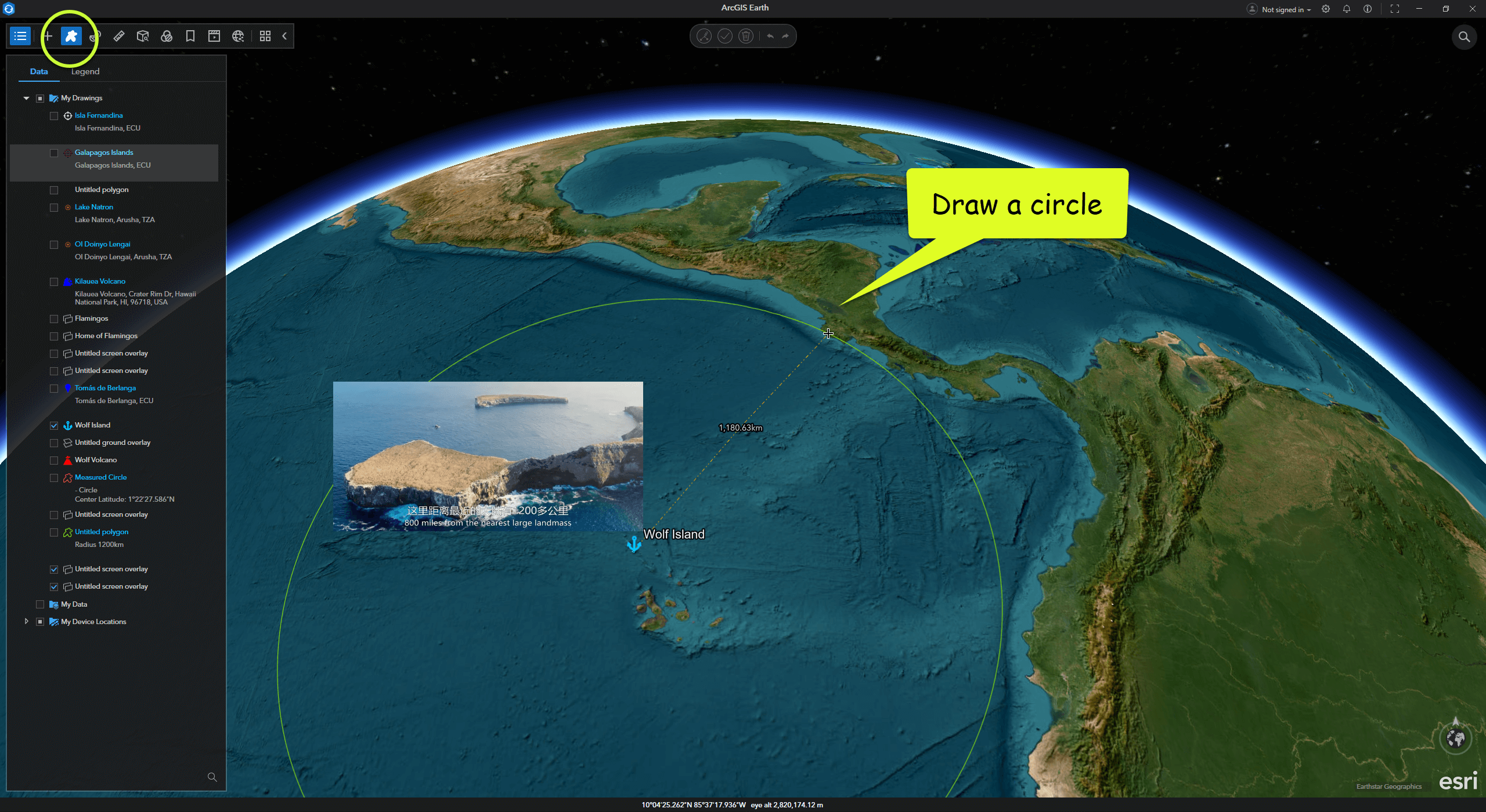
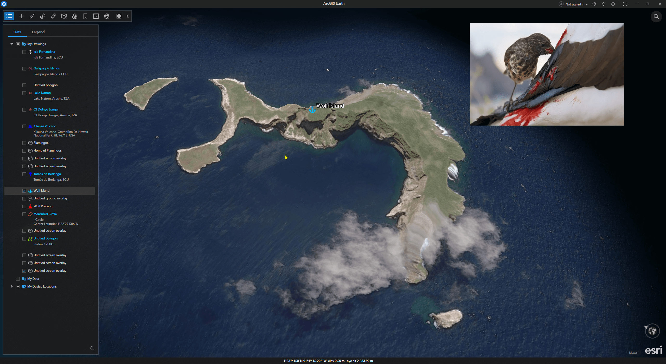
Survival on this isolated volcanic island seems to have activated “hell mode.” To adapt to the harsh environment, animals here have evolved rapidly. On this barren island, small finches have evolved into a blood-sucking species—the vampire finch.
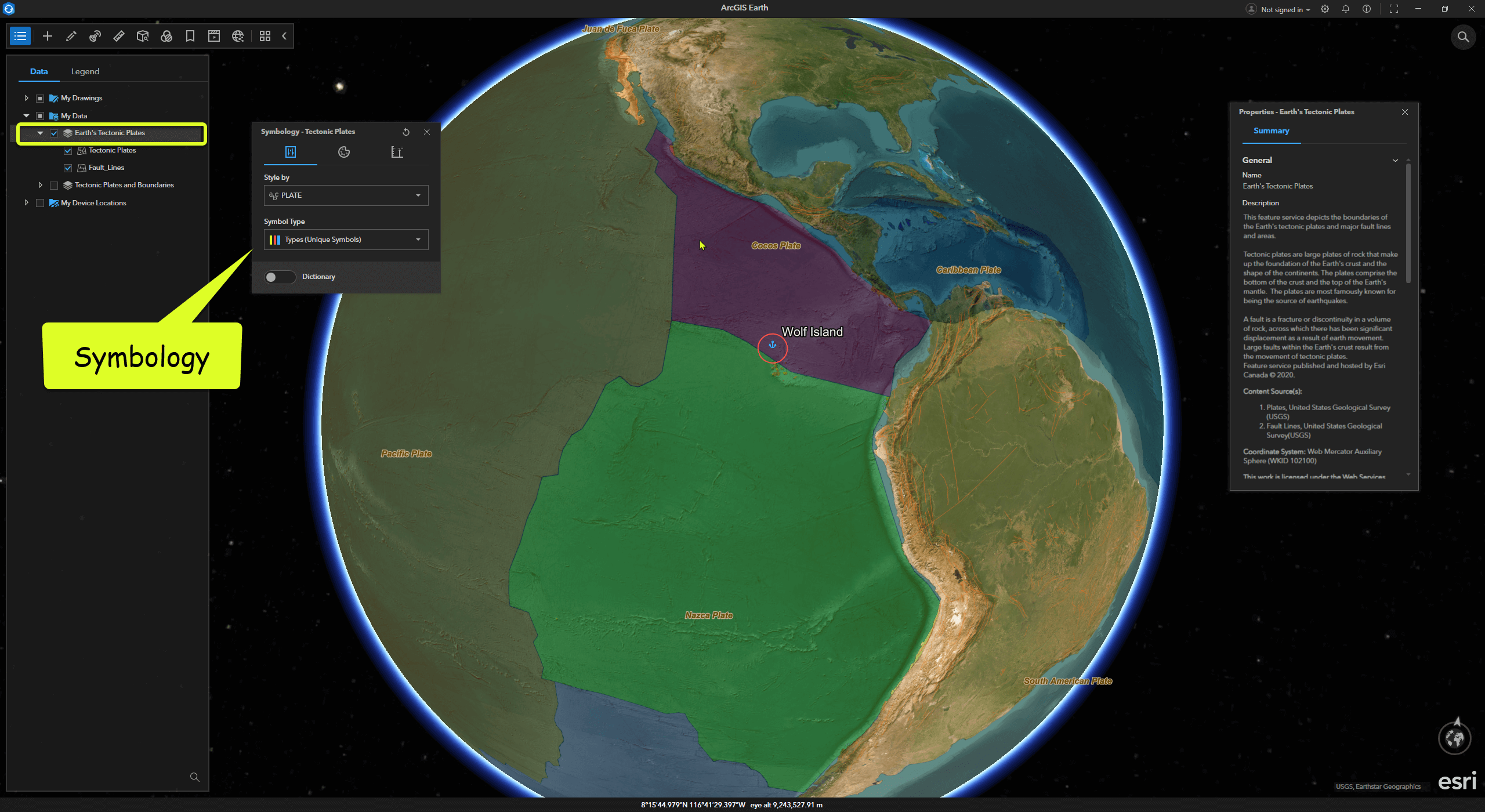
If you’re interested in tectonic plates, in ArcGIS Earth, you can click Add Data and search keywords like “Earth” or “Tectonic.” Among the publicly available resources on ArcGIS Online is Earth’s Tectonic Plates. After adding this data to ArcGIS Earth, we can clearly see that the Galápagos Archipelago sits at the intersection of three major tectonic plates: the Nazca, Cocos, and Pacific Plates.
05 Aldabra Atoll
Like living organisms, volcanic islands do not exist forever. Once the volcano’s interior becomes dormant and dies, external forces gradually erode it, forming atolls.
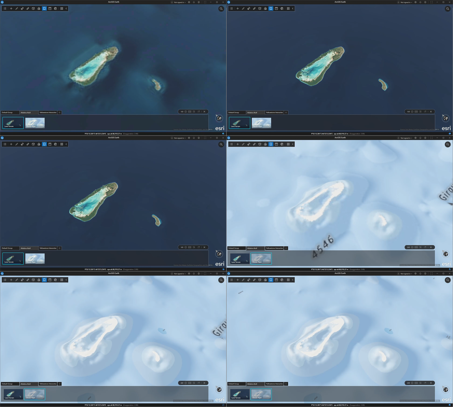
There are hundreds of atolls in tropical oceans, all remnants of volcanoes. The Aldabra Atoll is one of the largest and most pristine atolls in the world, located in the Indian Ocean about 420 kilometers north of Madagascar. It is also known as Turtle Island because it is home to giant tortoises.
In ArcGIS Earth, the default basemap is the global imagery map—Imagery. Users can replace it with other basemaps based on their needs, such as switching to Ocean to explore the underwater terrain of atolls. In addition to basemaps, ArcGIS Earth’s default elevation layer is Terrain, which provides global elevation data. Users can also add additional elevation layers to highlight terrain features, such as adding TopoBathy3D to better visualize underwater terrain.
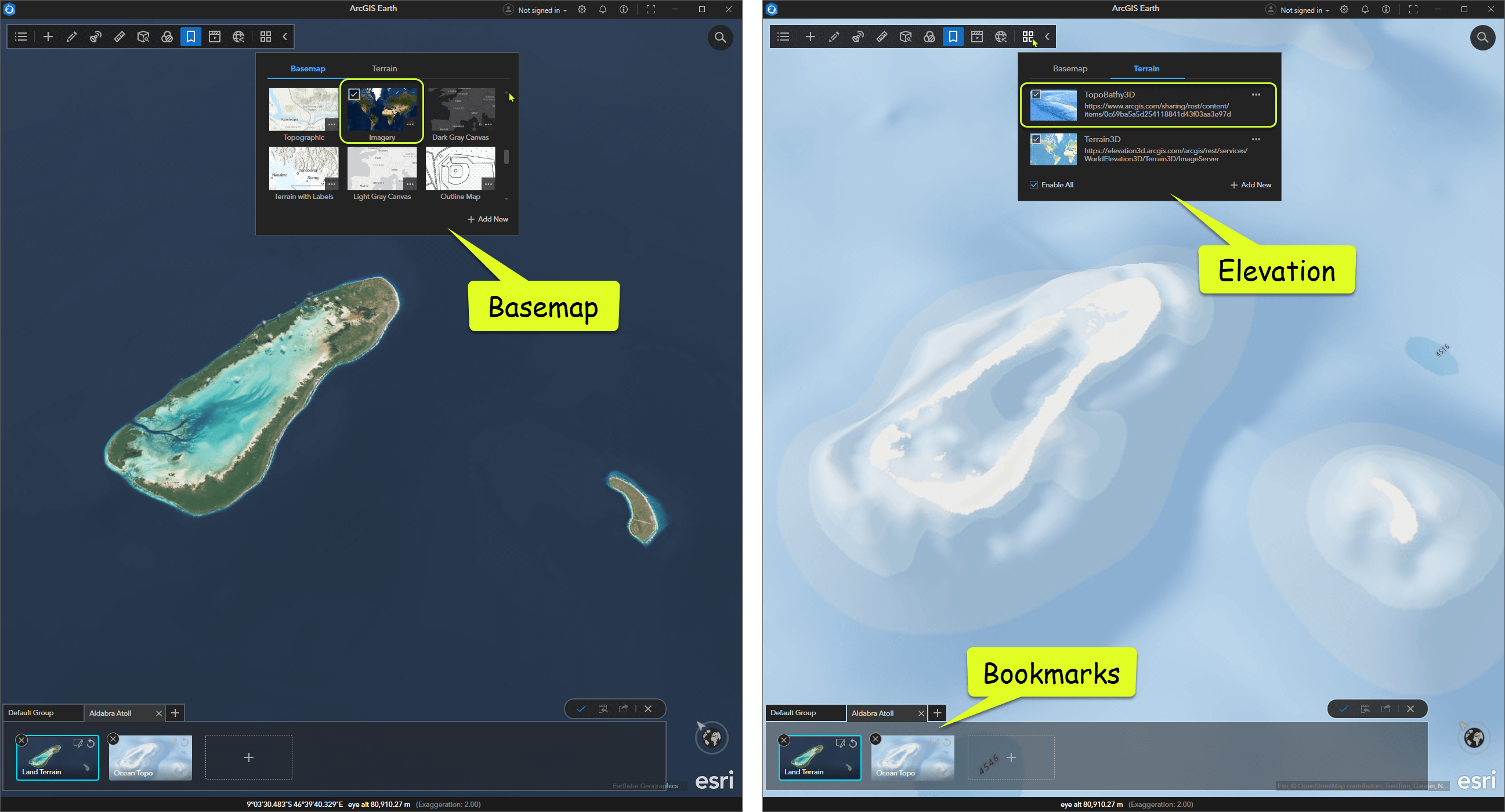
Bookmarks in ArcGIS Earth act as a “geographic favorites” tool, allowing you to save the current scene’s camera position, basemap, terrain, and other settings, enabling quick one-click switching between different scene configurations.
From basic navigation to simple geographic observation, we’ve taken our first steps in using ArcGIS Earth. In the next article, we’ll delve deeper into the allure of volcano topography and 3D scenes, unveiling more geological secrets hidden beneath the surface.
Download ArcGIS Earth
ArcGIS Earth is a free tool available for download. It allows you to add many publicly shared free resources from ArcGIS Online, including those from Esri, industry leaders, and individual enthusiasts. The videos featured here were created using this content. While video quality may be compressed for uploading, for the best experience, you’re encouraged to try it out for yourself.
If you’re interested, here’s where you can find versions for different platforms:
https://www.esri.com/en-us/arcgis/products/arcgis-earth/downloads