Dormant Wonders —— Exploring Yellowstone and Kamchatka with ArcGIS Earth
Besides the lava-spewing volcanoes we often see in the news and the underwater volcanoes introduced in the previous article, there are also dormant volcanoes hidden beneath the surface. Their heat erupts as geysers and hot springs.
06 Yellowstone
Let’s shift our focus to Yellowstone National Park in the United States. This is a dormant volcano where magma still flows underground. The heated groundwater boils, creating geysers. In some areas, water and sediments mix to form boiling mud.
This heat provides food for animals. The film features a battle between coyotes and otters, and you might come to admire the “cool-under-fire” otter after watching it.
In ArcGIS Earth, search for Yellowstone in the top-right corner to locate the park in the heart of North America.
ArcGIS Online and Living Atlas offer a wealth of global open geographic data. These resources can be easily accessed in ArcGIS Earth. Click “Add Data” from the toolbar and search for Yellowstone to find many related datasets.
For instance, you can add a Web Map dataset like “Yellowstone Interactive Map” to explore the park’s boundaries and details.
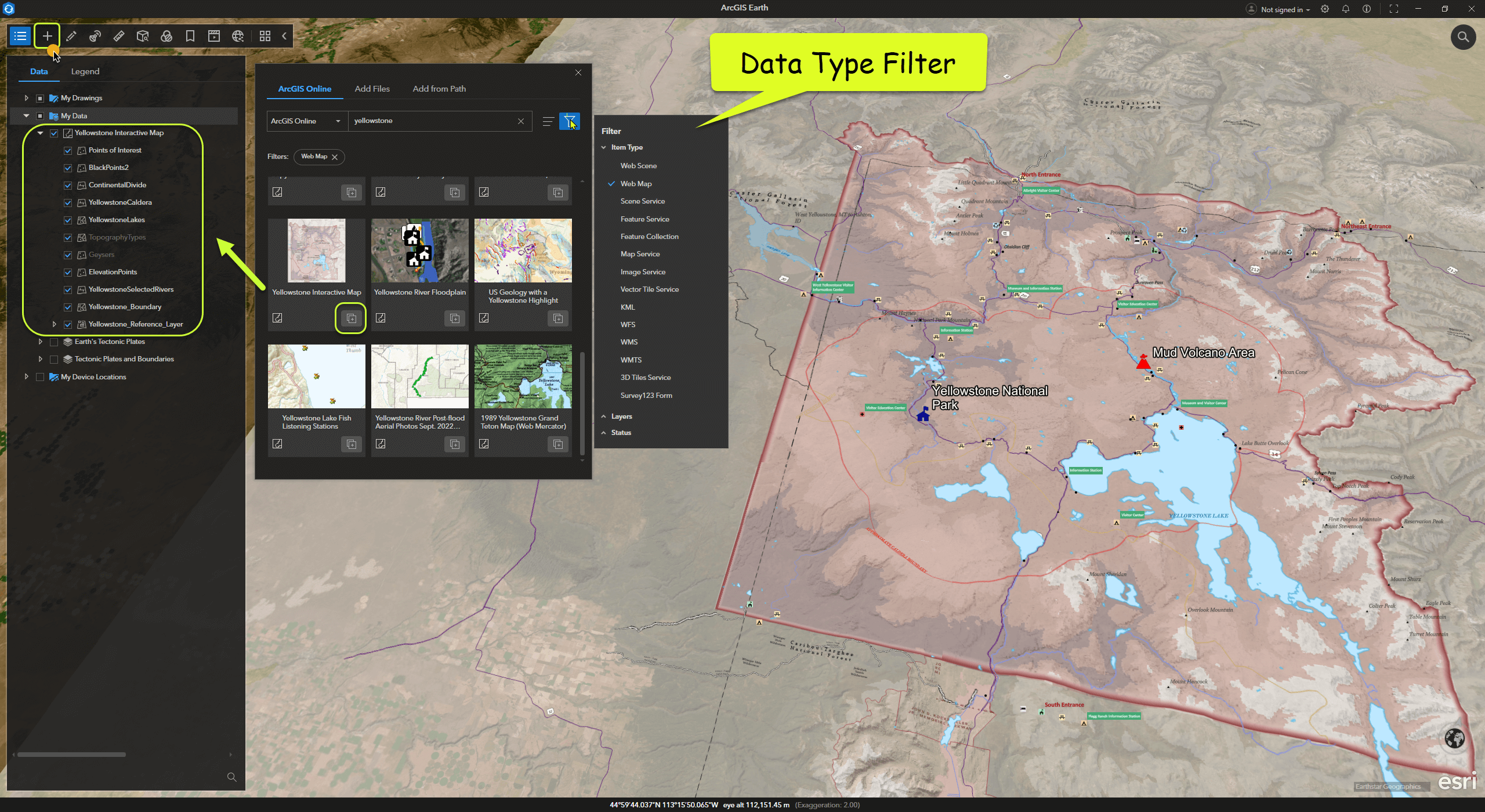
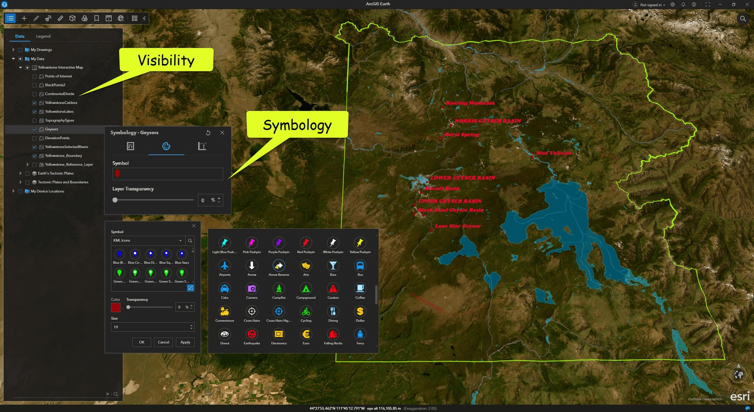
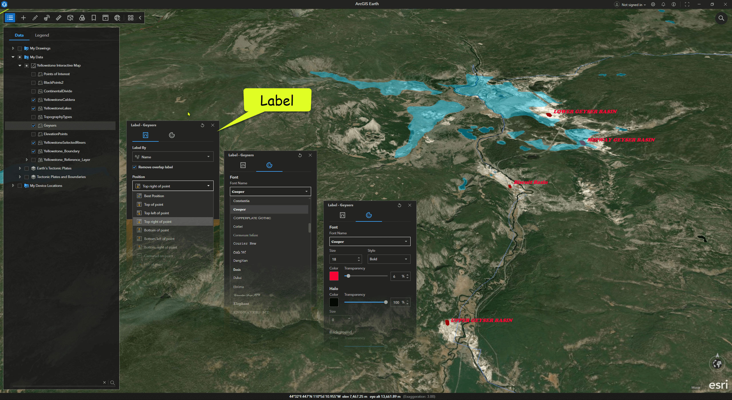
In ArcGIS Earth’s Table of Contents, each layer has a right-click menu with many configurable options, such as symbols, labels, and attribute information. Users can experiment with their map styles as needed.
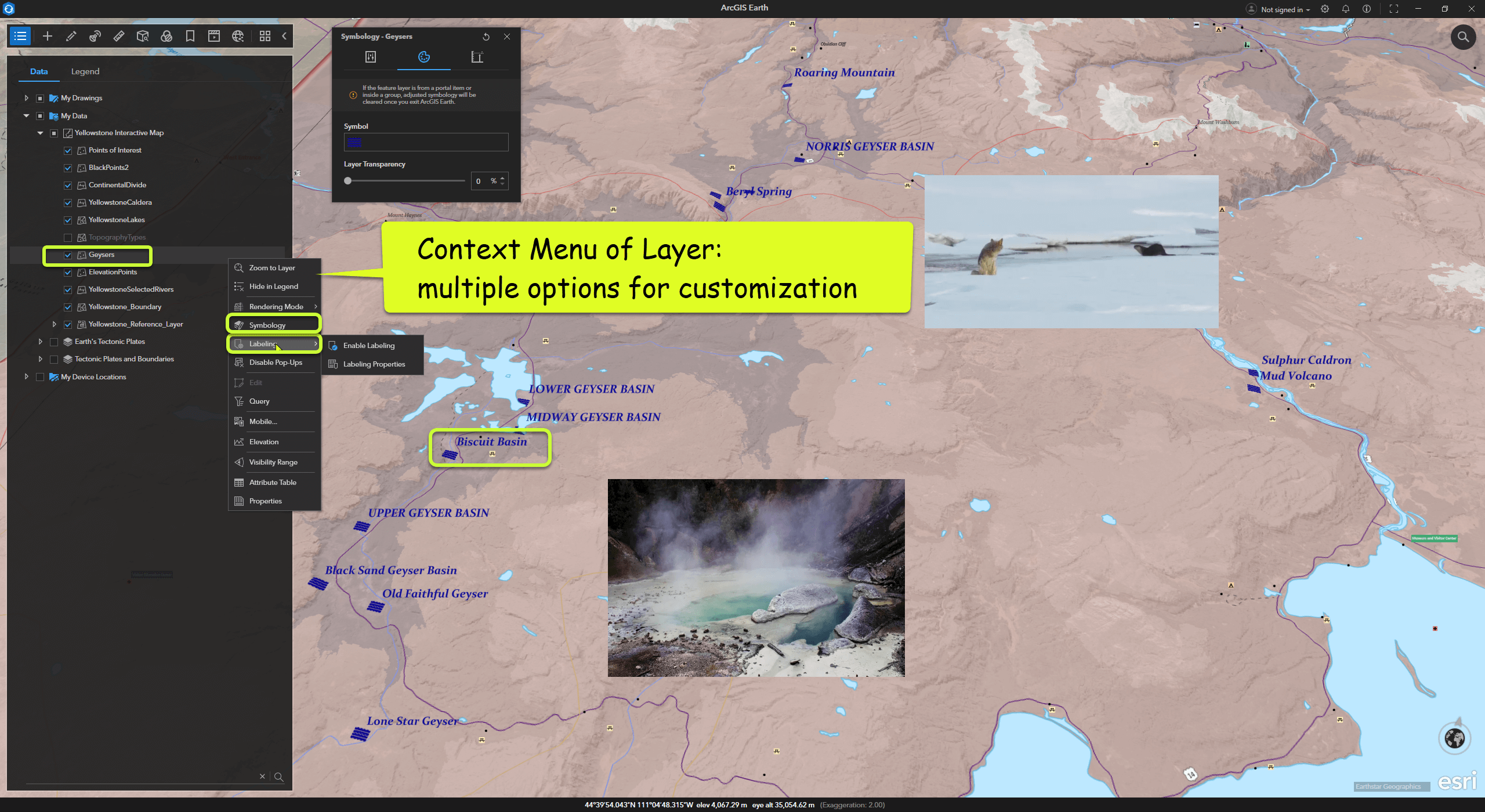
This dataset includes a geyser layer. Modify the symbols and labels to highlight it, and keep only the necessary data layers by unchecking the rest.
07 Kamchatka Peninsula
Heading north, we reach the frigid expanse of Russia. In the isolated, ice-covered valleys of the Kamchatka Peninsula in the northwestern Pacific, many geysers spout scalding steam.
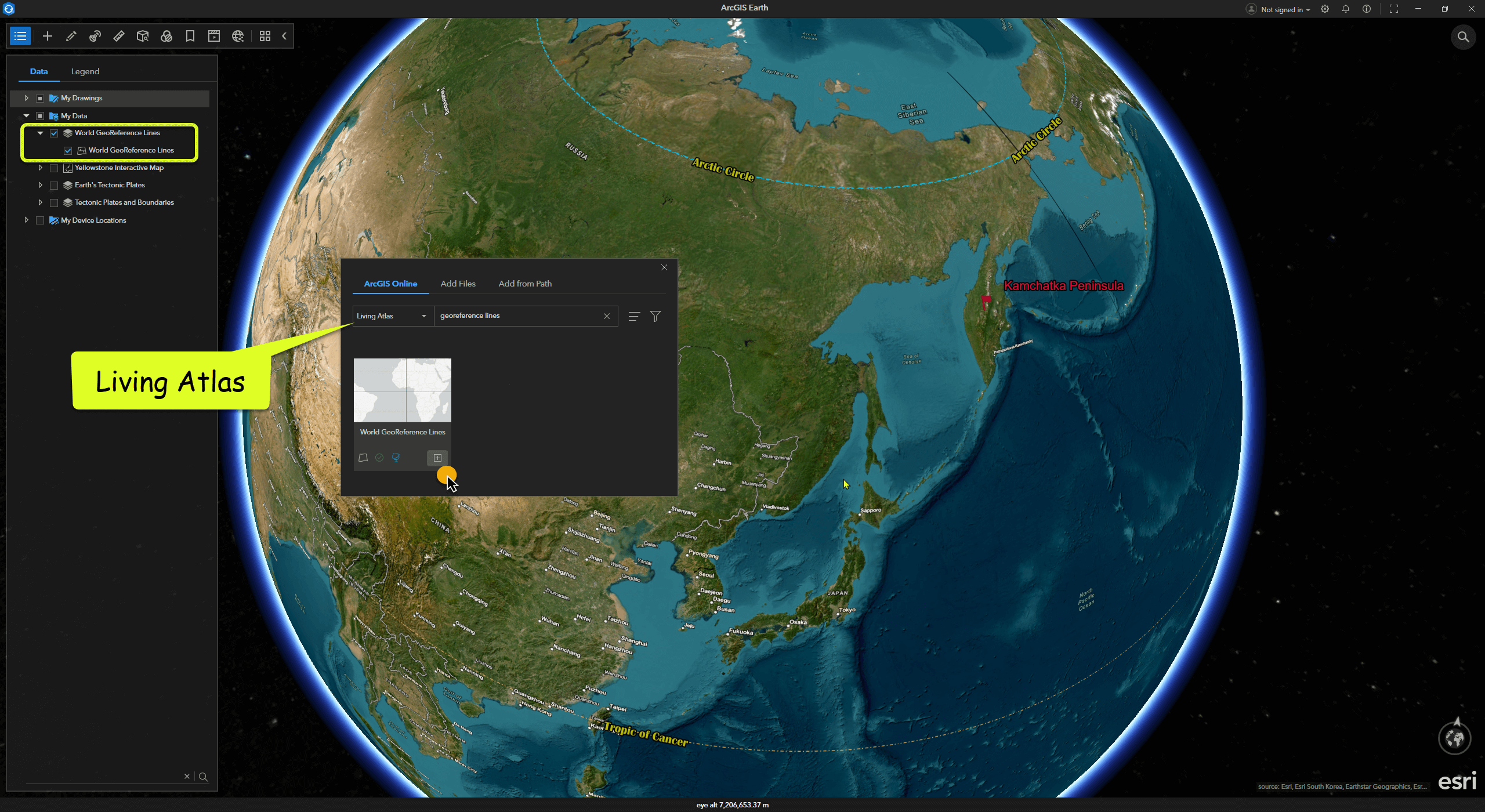
In ArcGIS Earth, add the World Georeference Lines layer from Living Atlas to observe the Kamchatka Peninsula’s location near the Arctic Circle.
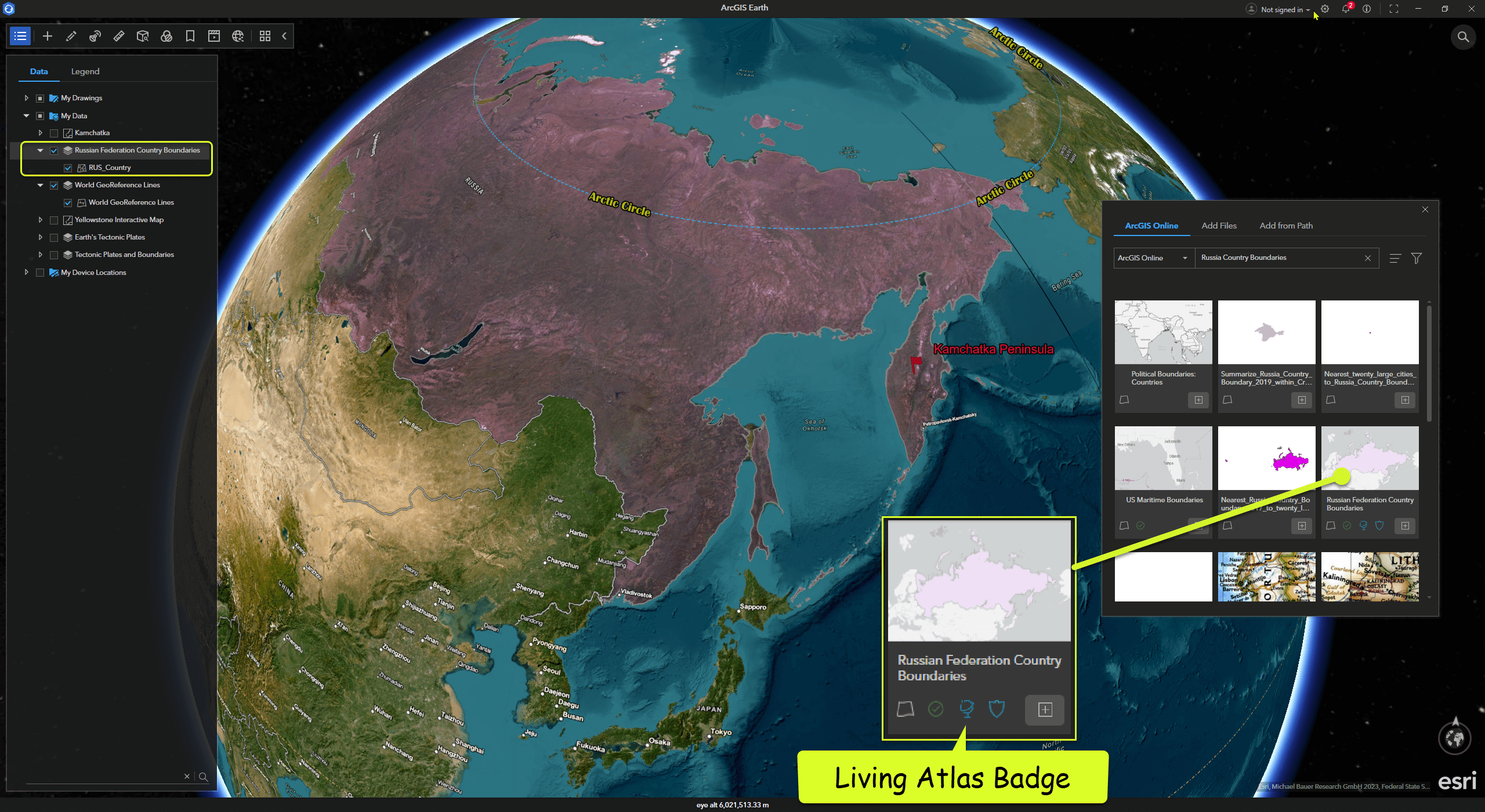
You can also find Russia’s national boundary data in ArcGIS Online - Russian Country Boundaries. A globe icon indicates data sourced from Living Atlas, which often signifies high-quality data.
Seeing such scenes in the film reminds one of the magical, secluded landscapes depicted in northern-themed fantasy works.
The brown bears living on the peninsula might be some of the happiest creatures on Earth. Fresh, nutritious food is delivered annually from the Pacific’s deep waters. Eating salmon isn’t a crime for these bears; in fact, not enjoying the fish, which die naturally after spawning, would be wasteful.
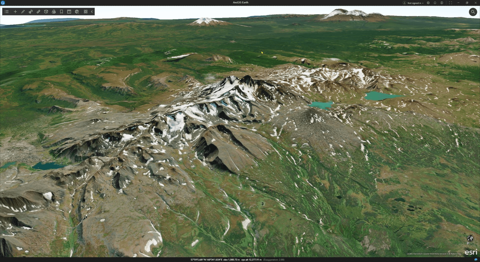
I randomly explored a few locations with ice lakes in ArcGIS Earth. The magnificent landforms and clear terrain patterns were truly exciting.
Open the Real-World Time Simulator “Daylight” in ArcGIS Earth to experience the transitions of day, night, and the galaxy of stars.
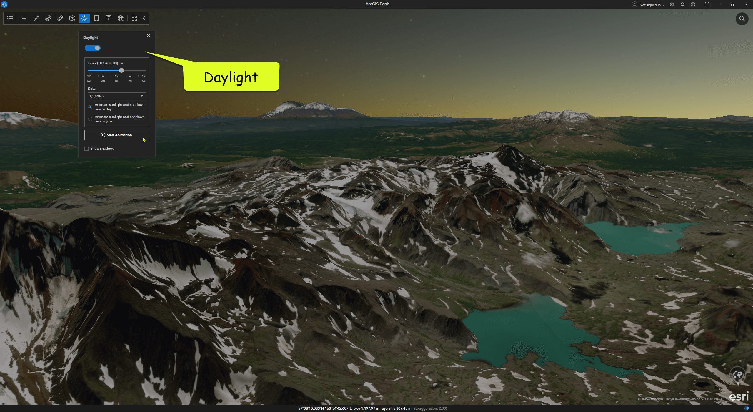
Time animation:
This concludes the volcano series. Stay tuned for updates on more interesting topics!