Volcanic Islands and Atolls — Exploring and Interpreting with ArcGIS Earth
Volcanoes are not only sculptors of the Earth but also windows for scientists to study geological activity.
Previous Article: In our previous exploration, we embarked on a journey using ArcGIS Earth to uncover the mysteries of volcanoes and familiarize ourselves with its basic operations. Today, let’s dive further into the three-dimensional world of volcanoes and explore the possibilities of combining terrain and data.
Leaving behind the perilous Fernandina Volcano, we continue onward. Following the lens, we slide northward in the eastern Pacific…
04 Wolf Island
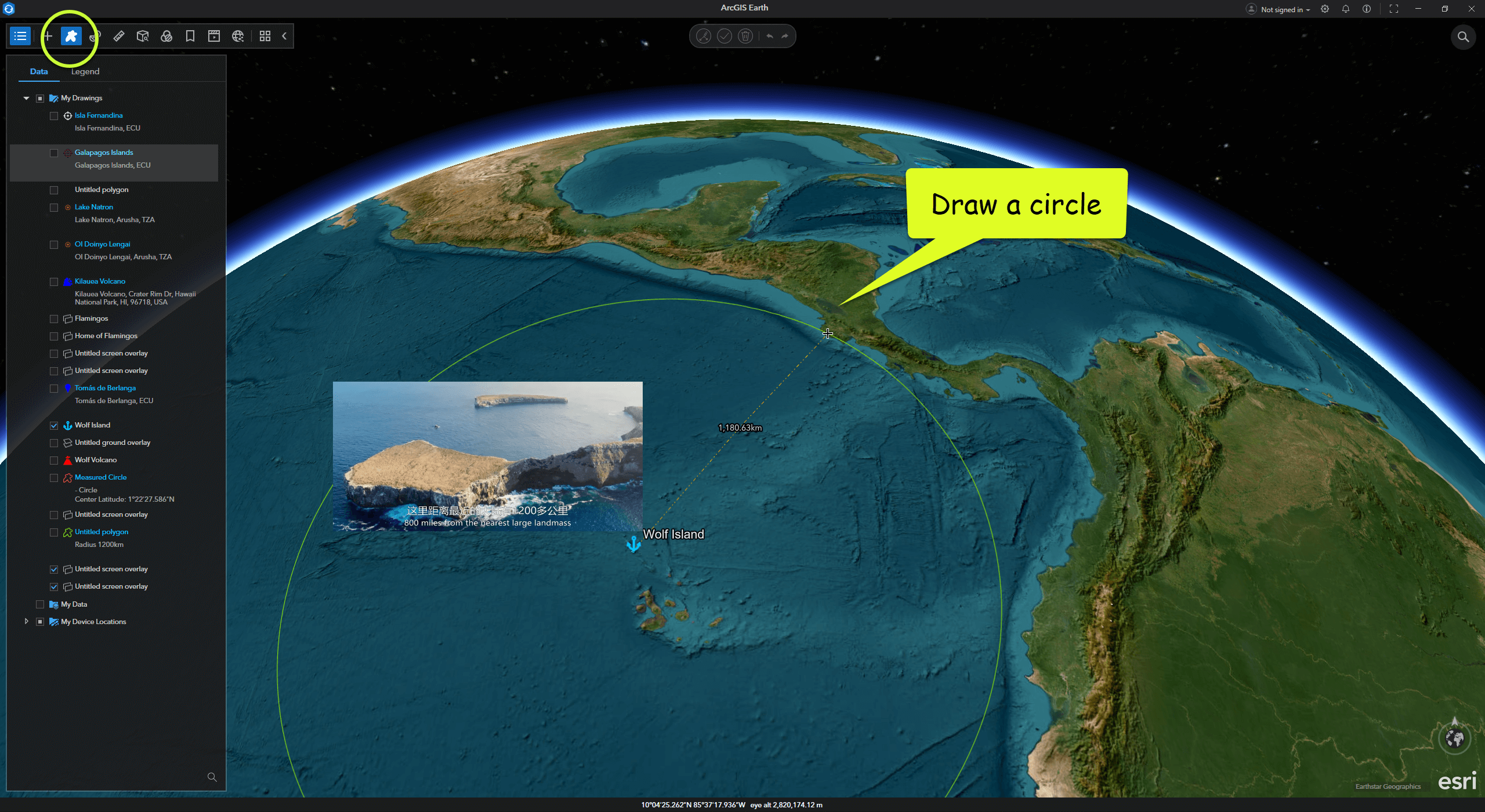
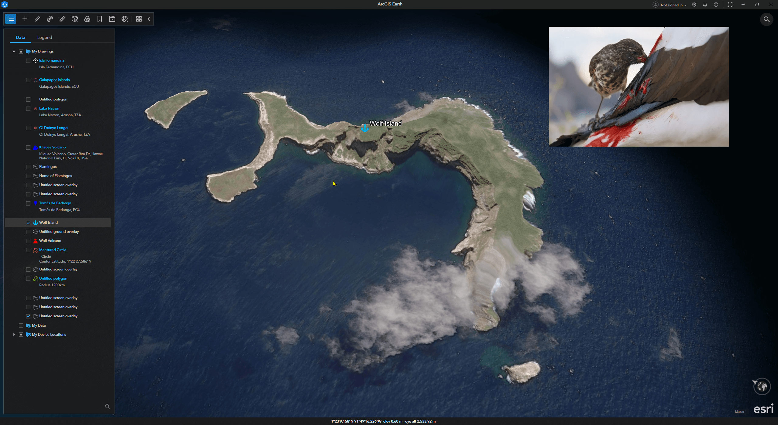
Wolf Island is a dormant volcano over a million years old, located more than 1,200 kilometers from the nearest continent. It is one of the most remote volcanic islands in the Galápagos Archipelago.
Survival on this isolated volcanic island seems to have activated “hell mode.” To adapt to the harsh environment, animals here have evolved rapidly. On this barren island, small finches have evolved into a blood-sucking species—the vampire finch.
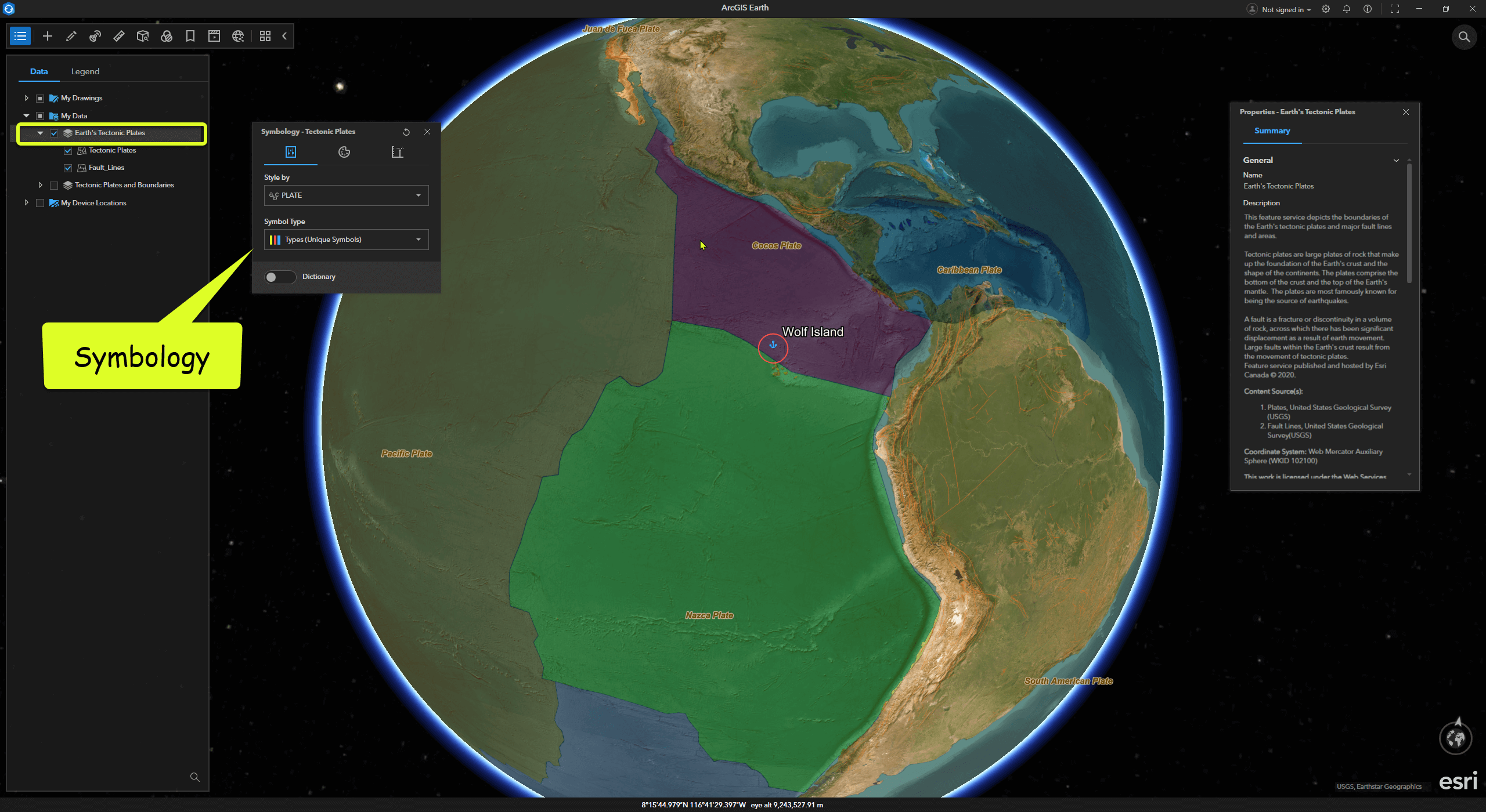
If you’re interested in tectonic plates, in ArcGIS Earth, you can click Add Data and search keywords like “Earth” or “Tectonic.” Among the publicly available resources on ArcGIS Online is Earth’s Tectonic Plates. After adding this data to ArcGIS Earth, we can clearly see that the Galápagos Archipelago sits at the intersection of three major tectonic plates: the Nazca, Cocos, and Pacific Plates.